Travel Day 10 -- Century Farm Family Campground, St Martins, NB, CA (45.351482, -65.544069)


Rainy weather this morning and everyone is closing up to get on the road. We are traveling in groups of three leaving at fifteen minute intervals. Our group is made up of
Rig #08 -- Bob Hamilton & Mary Clapsaddle
** 2011 35ft Holiday Rambler Trip Class A Front End Diesel Motorhome with a 2005 Honda CR-V Toad
Rig #11 -- Bob & Michelle Hazlett
** 2011 31ft Keystone Cougar High Country Fifth Wheel pulled by a 2010 Dodge Ram 1500 Hemi
Rig #17 -- Jim Leibold & Linda Brown-Vidal
** 2003 25ft Airsteam Safari LS Travel Trailer pulled by a 2011 Ford 250 truck
Our route for today is planned to be 204 miles and estimated at 3:41.

Since we are all new to this there was some confusion but not much and our group rolled out at 0941 EDT. We didn't get but a few miles down the road to Ellsworth when we hit the first glitch in the instructions.
Insturctions said to "follow Rt 1 south through Ellsworth then follow ME 179" Didn't mention that Rt 1 turns left and it is Rt 1A that continues straight. We followed Rt 1 but not too far. Did a U turn to get back and pick up 1A. Of course the GPS was screaming "Recalculating" all the while. Some of us did not turn around and followed Rt 1 all the way to Bangor before they got themselves straightened out and worked their way back on course. They went quite a distance out of their way and missed the thrill of driving about 25 miles on Maine Rt 179. That road just about jarred our teeth out and had us wondering if this is what is in store for us for the next 54 days. "179" became the first road with a reputation.
It was 102 miles into the trip when we reached the border crossing at Calais, Maine on the US side / St Stephen, New Brunswick on the Canadian side (US Rt 1/CA Rt1).
Our crossing was smooth and uneventful but we did see other rigs from our group pulled aside for closer inspection. They had tales to tell when we got settled in this evening. Notice the signs in both English and French. That will be the norm for our entire trip.
With our first gas/lunch stop came the adventure of one Class A (diesel), one Fifth Wheel (Gas), and one Bumper Pull (Gas) all trying to negotiate our way into an unknown travel center and get to the appropriate pumps. We made it and had a decent sit down lunch. Back on the road we reached Century Farms Campground at 1511EDT (1611ADT). Actual distance was 204 miles and elapsed time was 5:30. That was pretty close considering the stop for lunch. We are now in the Atlantic Time Zone. Got to fix all the clocks and watches.
Upon arrival, the "Parking Committee"swung into action. Getting nineteen rigs into a muddy campground and setting up in the rain was real fun.
We finished off the day with a social hour / information meeting. Poor Larry Marola, the assistant wagon master and person responsible for the driving directions, got a lot of grief. Oh my! What lies ahead?
This evening I tried to set up the TV running on the antenna -- only two channels and not very good reception. We are very spoiled.
A few words on the Provincial Flags of Canada. They are of course counterparts to our state flags. My quick observation is that they are flown more frequently than our state flags. I will try to throw in a little bit of information on each flag when we enter the province. Here is the scoop on the flag of New Brunswick. Adopted by proclamation on February 24, 1965, the symbols on the flag were taken directly from the Armoral Bearings originally granted to New Brunswick in 1868 by Queen Victoria. The gold lion on a red background represents the Duchy of Brunswick, a possession of Britain's King George III who ruled in the year of New Brunswick's creation in 1784. The galley, with oars in the water, represents New Brunswick's early seafaring industrial history.
Travel Day 9 -- Timberland Acres RV Park, Trenton, ME (44.507341,-68.388820)
Today Michelle and I traveled south on Route 102 along the west side of Sommes Sound to visit the towns of Southwest Harbor and Tremont.
Southwest Harbor is a town located on Mount Desert Island, with a population under 2,000. It has one school, Pemetic Elementary School.
Southwest Harbor has a Coast Guard Station. Everytime I see a Coast Guard Station, I recall that the Coast Guard doesn't have a bad duty station.
Hinckley Yachts maintains its headquarters, design, construction, and repair facilities in Southwest Harbor. Hinckley Yachts, founded in 1928, is a manufacturer of luxury sailing yachts and jet-powered picnic boats. In an effort to keep its reputation of fully handcrafted boats, Hinckley relies on a manual assembly line process to create its yachts, meaning widespread automation is nearly impossible. Due to the custom format of the yachts, Hinckley does not go through model years, rather it attempts to make “two major changes per year” to its line of vessels. The Hinckley Company (the mother company of Hinckley Yachts) also provides such services as yacht service, yacht brokerage, charters, and boat insurance. Hinckley currently conducts operations in seven locations across the North East and South East regions of the United States.
Hinkley builds both motor yachts and sailing yachts.
We motored along Rt 102 to the village of Tremont and spent a little time at Bass Harbor Head Light Station.
Bass Harbor Head Light is a lighthouse located within Acadia National Park on the southeast corner of Mount Desert Island, Maine, marking the entrance to Bass Harbor and Blue Hill Bay.
This plaque gives information on the bay and the light.
The lighthouse was added to the National Register of Historic Places as Bass Harbor Head Light Station on January 21, 1988. Today, the house is a private residence for a local Coast Guard member and his family. Tourists can get close to the bell and light via a concrete path, but most of the grounds remain private. There is a short walk which takes you to a series of wooden steps that lead you down onto the many granite boulders that provide a great view of the harbor side of the lighthouse and the harbor itself.
This awesome photograph of Bass Harbor Head Light is by Matt Shetzers. Check out his website for more of his photography and his workshops.
This is the lighthouse and the residence
By then our stomachs were yelling for lunch. Finding nothing along the road, we continued on to Bar Harbor and sought out someplace on the water. That turned out to be Stewman's Lobster Pound, where we began our serious efforts to over indulge on seafood. Michelle had a Lobster Roll and I had a bowl of Seafood Bisque. Stewman's Lobster Pounds are the only authentic oceanfront lobster pounds in Bar Harbor, Maine.
We spent the afternoon packing the Cougar and joined our caravan buddies for an "Empty the Fridge" dinner to get rid of all the stuff we can't take across the border into Canada. It was a good opportunity to get acquainted with our travelling companions.
Here we are. Thirty-seven souls about to take off on a 54 day adventure through the Maritime Provinces of Canada -- New Brunswick, Prince Edward Island, Nova Scotia (both islands), and Newfoundland (but not Labrador).
Some in the group are close friends, some are casual acquaintances, some are strangers. I think I can safely say everybody knows someone and nobody knows everyone. In our case, the only people we know well are Carole and Nelson Hommel.
Travel Day 7 -- Timberland Acres RV Park, Trenton, ME (44.507341,-68.388820)
Geography lesson. You may not need this but I did and I've been here before. This is my effort to get these often confused words straight: Bar Harbor, Acadia National Park, Mt Desert Island, Trenton, Trenton Bridge, and Cadillac Mountain.
Mt Desert Island is a very LARGE island located a very LITTLE distance off the coast of the US at Trenton, ME. It is connected to the mainland at Trenton, ME by the Trenton Bridge (imagine that). Mt Desert Island is part of the state of Maine.
Physically located on Mt Desert Island are the town of Bar Harbor, Acadia National Park, and several small villages. Acadia National Park property occupies nearly half of the island in several disconnected segments plus a scattering of smaller islands, and the Schoodic Peninsula. Schoodic Peninsula is the only section of Acadia National Park that is located on the mainland of Maine. Shared by the towns of Gouldsboro and Winter Harbor, the peninsula is in a more secluded type setting. Spectacular panoramic views of Frenchman Bay and Mount Desert Island can be seen from Schoodic Head's 440 foot high point. The town of Bar Harbor is not part of Acadia National Park. Cadillac Mountain (44.352624,-68.225101) is part of Acadia National Park and is the highest elevation (1,530 ft.) on Mt Desert Island. If you stand on Cadillac Mountain at dawn you will be the first person in the US to see the sunrise.
Michelle and I spent the day walking and driving around Mt Desert Island. We drove up to the Cadillac Mountain parking lot and spent about an hour taking in the scenery from the "summit". Cadillac Mountain is a famous and well-worn tourist site, so the road and walking paths are paved and well maintained. This is definitely not wilderness. The town of Bar Harbor is in the background behind Michelle.


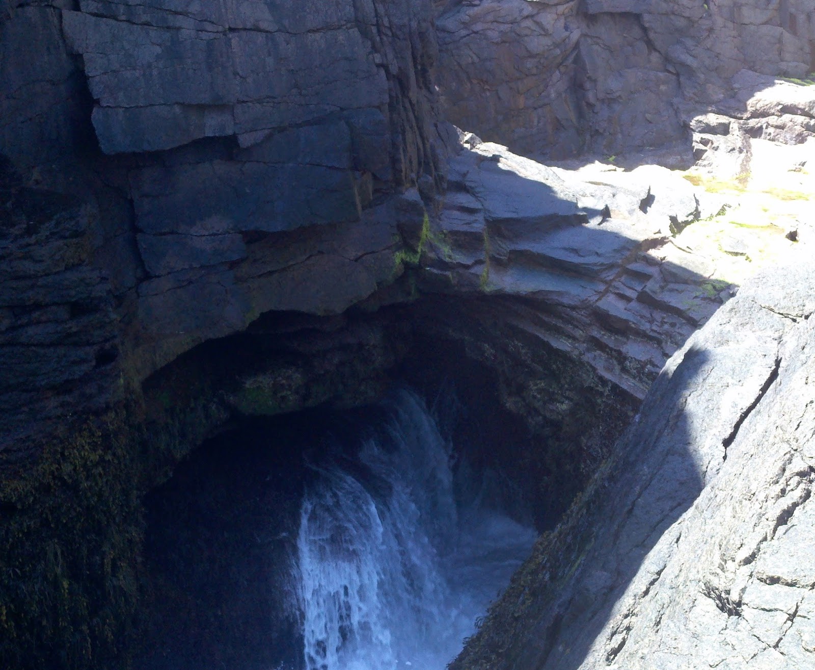
Our next stop on the Park Loop Rd was Thunder Hole. This was impressive to me. My favorite photography subject is "water on rocks". I am always a little bit in awe with the "irresistible force meeting the immovable object" for millions of years past and still working at it. I also love the sound of waves crashing on rocks. That sound is amplified significantly at Thunder Hole and it changes volume and tone as the tide changes.


This evening was spent with friends. George and Gloria Bursey are friends from The Great Outdoors. While wintering in Florida at The Great Outdoors they live on Fawn Trail. Their primary home is in Trenton, ME. It is a beautiful waterfront property that can be seen from Trenton Bridge as you leave Mt Desert Island heading north. This evening Nelson and Carole Hommel, Ruth and Bernie MacDonald, and Michelle and I took them to dinner at Jasper's Restaurant in Ellsworth. I had the Haddock Special and Michelle had Swordfish.
In case you're wondering, the signal flags across the top of the sign spell J-A-S-P-E-R-S. No flag for the apostrophe.
Travel Day 6 -- Timberland Acres RV Park, Trenton, ME (44.507341,-68.388820)
Today the weather was beautiful all day so Michelle, Carole and Nelson Hommel, and I went out to explore the small villages of Maine near Bar Harbor and wound up in Bucksport, ME, a town in Hancock County, ME with a population of about 5,000. Bucksport is an historic town across the Penobscot River estuary from Fort Knox and the Penobscot Narrows Bridge. If this really excites you, learn more at wikipedia.


Towering over this little town is The Penobscot Narrows Bridge, a 2,120 feet long cable-stayed bridge over the Penobscot River connecting Verona Island, ME to Prospect, ME. It replaced the Waldo–Hancock Bridge, built in 1931 which you can see in the background of this early photo.

The Penobscot Narrows Bridge is one of three bridges in the US (the others being Zakim Bridge in Boston, Massachusetts, and Veterans' Glass City Skyway in Toledo, Ohio) constructed recently to utilize a cradle system that carries the strands within the stays from bridge deck to bridge deck, as a continuous element, eliminating anchorages in the pylons. Each epoxy-coated steel strand is carried inside the cradle in a one-inch steel tube. Each strand acts independently, allowing for removal, inspection and replacement of individual strands. The cable-stay system was designed with a system that uses pressurized nitrogen gas to defend against corrosion. In June 2007, six reference strands within three stays were replaced with carbon fiber strands – a first in the US. Monitoring on the strands will evaluate this material for future use in bridge designs. These engineering innovations helped the bridge appear in the December 2006 edition of Popular Science as one of the 100 best innovations of the year. The total project cost was $85 million.
The bridge was designed as an emergency replacement for the Waldo–Hancock Bridge. From conception to completion, just 42 months elapsed. A unique project delivery method, referred to as "owner facilitated design/build" partnered Maine DOT with FIGG as the designer and Cianbro/Reed & Reed LLC as the contractor. The elevator system in the tower, which is claimed to be the fastest and tallest elevator in Maine, was installed by Stanley Elevator Company, Inc.


All the Oooing and Ahhhing about this wonderful engineering accomplishment (Nelson and I were impressed, Michelle and Carole not so much) made us hungry. So for lunch we found a local establishment with a nice view and easy parking. As it turned out The Harbor View Grille had a good menu and served us four delicious lunches.


Michelle had a Fishburger and I had a Tunamelt and Seafood Chowder combination. We both finished off with Blueberry Pie with Vanilla Ice Cream after listening to the waitress talk about the woman who comes to the restaurant a couple days a week just to bake pies. It seems I have heard about the baking lady somewhere else. Since she only drives her car to church on Sunday, she must walk to the restaurant to bake pies. Hmmmmm.
Is this a preview of meals to come? I think we'll skip dinner tonight.
Travel Day 5 -- Timberland Acres RV Park, Trenton, ME (44.507341,-68.388820)
Even though today was a short trip, we got off to an early start at 0730 EDT for our 208 mile five hour run from Kittery, ME to Bar Harbor, ME.

Our one fuel stop was at West Gardiner Service Plaza on the Maine Turnpike. That turned out to be an exceptionally educational fuel stop and I did a separate post on the Truck Stop Electrification (TSE) that I encountered there.
We pulled into Timberland Acres RV Park just after noon. This RV Park is in Trenton, ME on the mainland just across the bridge from Bar Harbor, ME.
Several caravan members including Carole and Nelson Hommel have already arrived, so we visited a bit and started meeting caravan members. Conversation started with stories about the road trip from Florida but it didn't take long for it to turn to DINNER. Everyone is ready for some real seafood and this area has an abundance of "Lobster Pounds". A Lobster Pound is a very simple eating establishment (many times just picnic tables) with big steaming vats outside. Lobsters, clams etc go straight into the steamer and then directly on your plate.
A meal is a glorious mess. Everyone needs a bath by the end. So most of us went to the Trenton Bridge Lobster Pound for a lobster dinner. Michelle gave lessons on how to eat a lobster.
This caravan is actually about to begin. Our first signup meeting was over a year ago. Departure time has finally arrived.