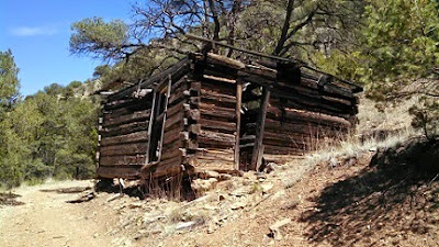
Pioneer Store Museum
Chloride, NM 87943
GPS Coordinates (in three formats):
N 33.338660o, W 107.681144o
N 33o 20.3196', W 107o 40.8687'
N 33o 20' 19.17", W 107o 40' 52.12"
Elevation: 6,186 feet
How many people drive 37 miles into the mountains of New Mexico for the Memorial Day weekend? Answer: A lot.
Our little Apache Kid RV Park was full starting on Thursday; so was the overflow dry camping area. Both of these could have been booked three times over.
Most folks who come to stay and camp do so for the 'four – wheeling' exploration of the canyons. They head out in the morning with a lunch packed in their ATV and return about 4PM; dust covered and happy.
Around here the canyons are deep and rugged.
Even in this out of the way wilderness you can feel safe because Chloride is a gated community.


No comments:
Post a Comment